The Machame-Mweka Route (also known as the Whiskey Route) is the 2nd most popular route to the summit (Uhuru Peak) of Kilimanjaro (Kibo).
It is a beautiful route passing through the rain forest , the dry and dusty Shira Plateau, the Barranco area with its senecios and "Breakfast Wall", the exquisite Karanga Valley with its water streams and finally the rocky and inhospitable Barafu - last stop before you make your midnight dash for the top of Kibo.
Itinerary
Please watch the video and then read the additional route information below!
Machame Route Video to follow soon!
Today's Machame hike is 5.12 miles (8.2km) and the altitude gain is about 3930ft (1200m)!
It is uphill all the way from the gate to Machame Camp.
At the gate, you have to complete some paperwork while your porters and guides weigh your luggage and pack their kit bags.
You start the climb at about 11am at 5970ft. The first 40 minutes are gentle and comfortable as you hike on a 4WD dirt road used by the rangers.
In general the first hour is a gentle uphill hike whereas the second hour to the lunch stop is a bit steeper with lots of man-made steps and avoiding the mud! When it rains, this can be a messy section!
Your guides should ask you to hike slowly and to ignore the hikers who think it is a race to the summit. Many of the fast hikers will develop altitude sickness later from ascending too fast.
Make sure to drink at least a liter of water before lunch and another after lunch!
The montane forest is beautiful and make time to look at the incredible variety of interesting plants and trees. Green moss hangs from the branches, while colorful flowers such as Impatiens Kilimanjari can be seen between the tree ferns.
If it starts to rain, stop immediately and put on your rain gear! It is very important not to get unnecessarily wet on Kilimanjaro as your clothes will not dry overnight.
Lunch is around 12:30pm and the 45-min break is most welcome for most hikers!
You may or may not be surprised with a feast in the forest! Cheap outfitters will give you a lunch bag with a few pieces of fruit and bread, while the top companies turn every meal into an occasion for their weary clients. You can expect a buffet-style lunch served on a light-weight table with comfortable chairs, a selection of hot and cold drinks and even a waterproof canopy in case of rain! The better companies will rig a private toilet tent with a porta-potti.
Do not think for a moment these "luxuries" are unnecessary. The top companies use carefully designed mealplans loaded with carbohydrates, they filter the water with expensive filters and they empty the toilet holding tanks in bush toilets instead of holes in the ground.
After lunch the climb gets steeper in places and you will be grateful if the trail is well-maintained to make it easier on the knees. You will follow a ridge with a stream nearby (audible to the right). There are 2 long-drop toilets on this stretch. Around 3pm you will hear a waterfall on the right and you may see it if you look carefully through the brush.
About 2 hours after lunch the forest starts to thin and grasses become more prominent. The steepness continues but at some point you may be able to see the summit area on the right in the distance if there are no clouds.
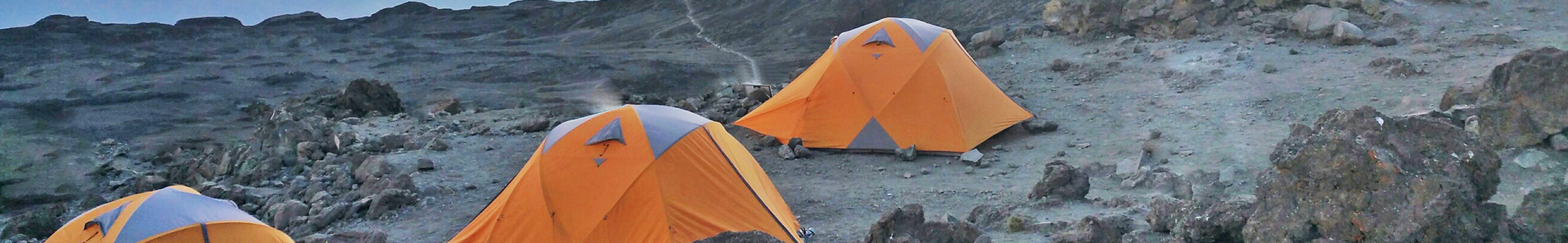
After another hour the green hut of the Machame Camp comes into view. It will be about 5pm when you reach camp at the edge of the forest at 9,973ft (3040m).
Everything should be ready for your arrival, including popcorn and hot drinks!
Tonight you will have about an hour or so before dinner, so take your time to get organized for the evening before it gets dark.
Please eat well tonight and finish another liter of water before going to sleep. At the higher altitudes you may lose appetite later so these first few days are important for building up energy reserves.
Darkness comes early in the forest and the clear sounds of the night will remind you that you are far away from home but finally camping on the slopes of Mount Kilimanjaro!
Please watch the Machame video and then read the additional route information below!
Machame Video to follow soon!
Today's hike is 3.15 miles (5km) and the altitude gain is about 2650ft (808m)!
Wake up call is 7am. Breakfast is served at 8:30 and you will start to trek at 9am.
The hike from the Machame Camp to Shira Camp is very different from yesterday. It is steep, but open and rocky. In fact, it can be rather dusty.
It is interesting to note how you will hike towards the West and not directly towards the summit of Kilimanjaro. This is for two reasons - traversing to the left is not as steep, and the longer trail allows for better acclimatization.
You begin with a short steep climb through trees with little vegetation. In the open landscape you will see the trail ahead as it winds along several ridges towards the edge of the Shira Plateau. It is clear that you have some hiking to do before this day is over!
You will be hiking in senecio country! Be sure to stop and to take pictures of the majestic Senecio Kilimanjari which grows into small trees up to 15 ft high.
Today's hike is steeper than yesterday but it will get easier and even more scenic after lunch so you will have something to look forward to!
Just before lunch, it gets quite steep. The last section is really a stamina tester before you climb up man-made steps to the hill before lunch. After about 3 hours of uphill climbing, the lunch stop is very welcome!
After lunch and a short rest (about 75 minutes) you continue your hike. The views of Kilimanjaro's Western Breach are wonderful (when the skies are clear) and you have to take every opportunity to take pictures!
The strange thing about today's hike is the constant uphill over one hill followed by another. There are hardly any downhills! You walk up to the top of a ridge only to find the next ridge waiting for you in the distance!
And so it continues for ridge after ridge. The path is clearly visible in the distance and those with good eyes can follow the porters as they disappear over the edge of Shira.
Near the start of the Shira ridge, the trail bends left and up. This will be the final uphill stretch of today's hike.
You are now in a rocky area full of caves and interesting plant life. The views to the south are just breathtaking.
After about 90 minutes of steep, rocky and dusty hiking you reach the lip of the Shira Plateau!
From there, it is only 20 minutes to camp and you will feel your pace quicken over the only flat terrain of the day!
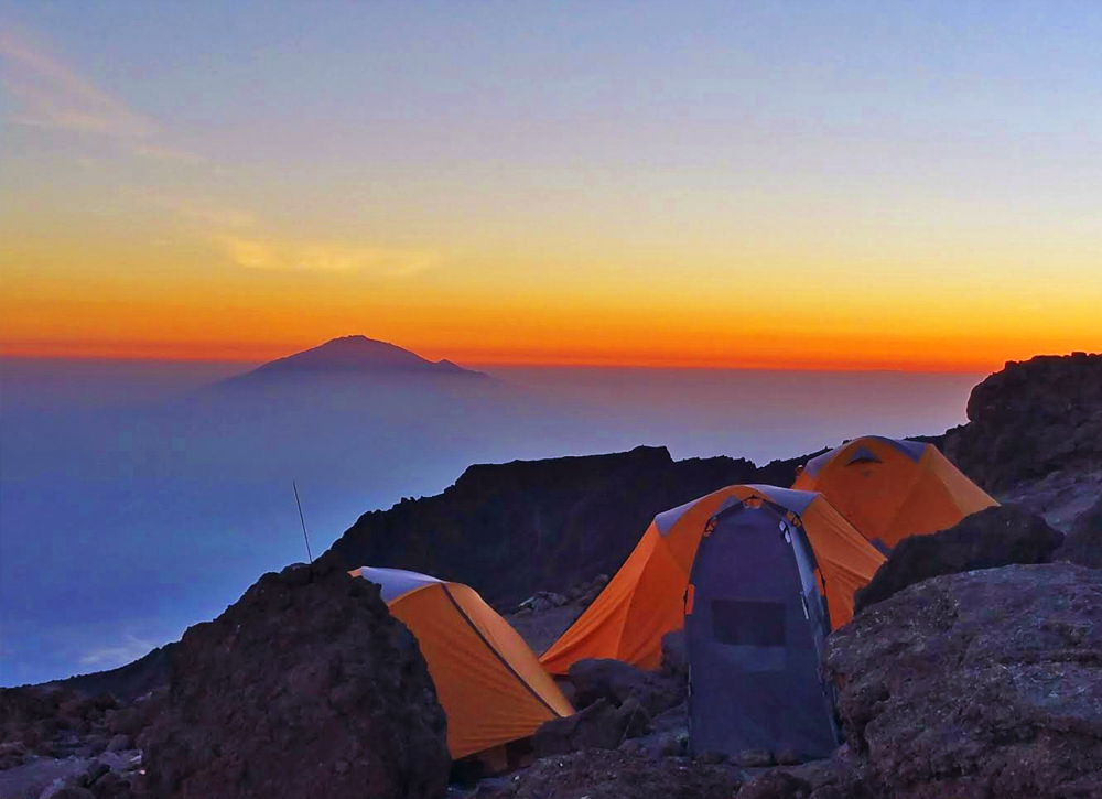
Expect to reach Shira camp at about 2pm. The camp is at 12480ft (3830m). In the early afternoon it is often cloudy and the views are hidden, but by 5pm the skies normally clear and the views towards Uhuru Peak and Mount Meru are memorable.
You will be thinking about a hot shower at the end of this day! Guess what? A few of the top outfitters can manage to construct light-weight shower tents on Kilimanjaro and they give their clients small amounts of hot water for fast, army-style showers!
Day 2 on Kilimanjaro is not easy and you may suffer from a minor headache as you drift off to sleep.
Please watch the Machame video and then read the additional route information below!
Machame Video to follow soon!
Today we will walk 6.5 miles (10.5km) and gain about 2820ft (860m) in altitude at Lava Tower before descending down to 13054ft (3980m).
Breakfast is served at 7:30 and we start our walk at 8:30am.
Today's hike is different in that we will hike to a high point before descending down to our next camp! We are "climbing high and sleeping low".
The first part of the hike is over pebbles and boulders. It is gentle and we zig-zag our way over the Shira Plateau towards the lunch stop at Lava Tower.
The vegetation is changing as we hike through the Alpine zone. Here the seasons meet. Summer by day and winter by night. Lichens are about the only plants that can survive in this area.
The good news is that we are now trekking East towards Kibo. It is comforting to see the mountain gets closer as the hours go by. Looking West, we can see some hikers on the trail coming from Shira and Lemosho. Our trails will soon meet.
After the trails meet, we can see Lava Tower in the distance. We continue along the flat but dusty trail until we see a juncture - going straight will take us to Lava Tower, turning right will take us down to Barranco. We go towards Lava Tower.
We reach Lava Tower around 1pm. We are at the highest point of today's walk - 15230ft. Some hikers will start to feel the altitude in the form of a mild headache.
We always try to climb the Tower to help acclimatization - a 30 minute climb that has its moments. In two places it is best not to look down! But the views from the top are well worth the effort and its height is good for acclimatization.
A 45-minute lunch is served next to the tower. From here it is almost all downhill to Barranco camp!
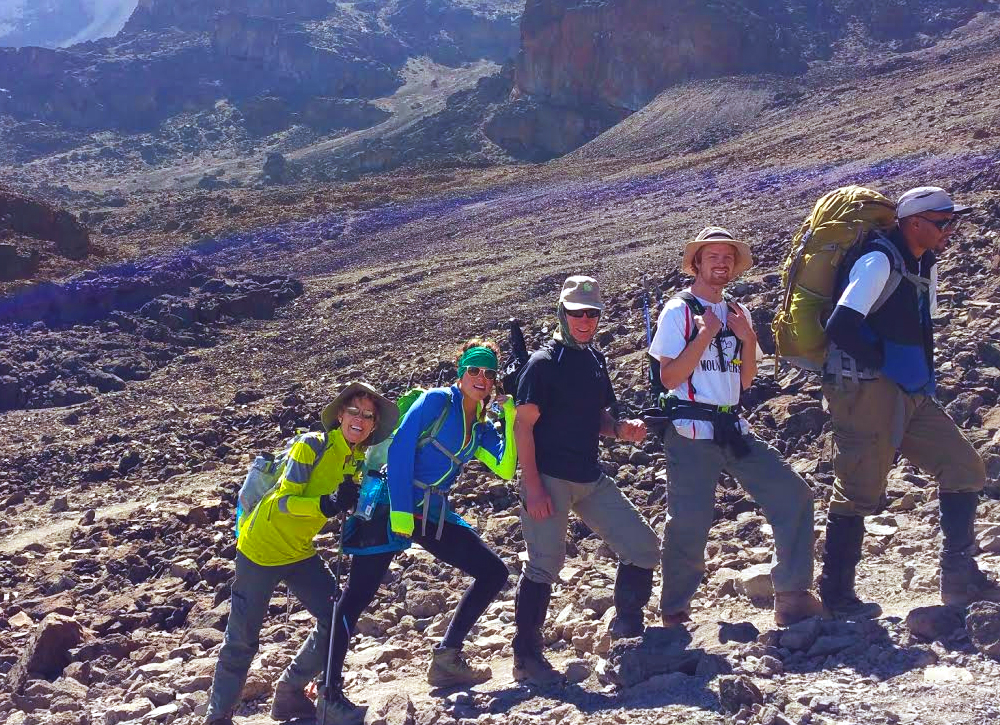
After lunch, we take our time descending into the Great Barranco valley. We see plenty of senecio and lobelia plants. It is very steep in some areas and we use our walking poles to steady ourselves. This is not the time to hurt an ankle or knee.
About an hour or so from camp we enter the bottom of the valley with several waterfalls and beautiful water streams. It looks like a giant garden. We stop often to take pictures—many say that this area is the most beautiful part of the mountain and it is hard to disagree.
At 5pm we reach Barranco Camp at 13,054ft (3978m). This is a beautiful camp with the dramatic Barranco Wall looming large to the north.
Today we climbed high and we will be sleeping low! This should make for a good nights' rest.
Please watch the Machame video and then read the additional route information below!
(Please Note - If you opted for a 6-day trek with our Explorer Package we will skip Karanga Camp and proceed on to Barafu camp)
Machame Video to follow soon!
Today we will walk 3.15 miles (5km) and gain only about 225ft (69m) in altitude!
Breakfast is served at 8:30 and we depart at 9:30am. We try to drink at least one liter of water before leaving camp!
Today's hike to the Karanga Valley is short but crucial for proper acclimatization. Some hikers will bypass the Karanga camp and head straight for Barafu Camp—not recommended because an extra night is good for acclimatizing!
Just north of camp, we cross a small stream before starting the long scramble to the top of the Barranco Wall (also known as the Breakfast Wall). The scramble looks more intense than it really is. Nevertheless, we must be careful and take our time; this is easy because of the long lines of climbers and porters. It is not uncommon to wait for 5 minutes or more at certain stretches.
Many people are concerned about the Barranco Wall. The truth is the following:
There are a good six or so places where you will use your hands and feet to scramble up and over the rocks. You will have to lift your legs about waist high and some balance is needed to avoid falling.
A fall will rarely be more than a few feet. There are one or two places where a slip may be fatal but we are not aware of any climbers who lost their lives on Barranco. Just take it slow and you will be fine. If you need extra insurance around one particular testy rock with a drop-off, a porter or guide will help you by holding your hand. It takes about 75 minutes to reach the top of the wall.
Once on top we will rest for 15 minutes and take plenty of pictures. From the top the Barranco camp is just a small dot in the distance!
Looking to the southwest, we can clearly see the trail towards Karanga Camp. The tough part is behind us but we have two steep uphills ahead of us and one very steep downhill.
The scenery is barren, dusty and dramatic. This is the alpine zone at its best. To our left, the slopes of Kibo are broken debris fields from rockfalls. To our right, the clouds form a carpet of white. On clear days we may see the towns of Moshi and surroundings.
After leaving the top of the Barranco Wall we walk downhill at a good pace before a short but steep uphill section.
Then we traverse a ridge with a nice flat section followed by a gentle downhill that ends in a rocky section full of plant life. Looking ahead across a valley, we should see our tents at the next camp!
From here, we descend steeply into the Karanga Valley with a welcoming water stream. Ahead, the final hill is very steep!
We reach Karanga Valley camp at 1:30pm. We are at 13,277ft (4046m).
Please watch the Machame video and then read the additional route information below!
Machame Video to follow soon!
Today we will walk 2.15 miles (3.5km) and gain about 1950ft (595m) in altitude!
It is a short hike with only 2 steep sections—at the start and at the end.
We continue our uphill climb across barren landscape with lots of boulders and shattered rocks. It is very quiet and peaceful. The Decken Glacier is always presence to your left.
Before we know it, we are standing on a ridge looking across a valley towards Barafu Camp in the distance! After a slow hike up that final hill, we reach a fork in the trail - the way down to Mweka is to the right. We will go left, following a very steep ridge until we reach a rocky section.
20 minutes later we reach Barafu camp amidst large rocks with dangerous cliff-faces.
We need to be careful here - some climbers have been killed when they lost their way during the night while looking for the long-drop toilets.
It is smart to take an acclimatization hike with our guides in the afternoon.
Tonight we will go to bed early (7pm) as the wake-up call is 11pm for the start of our midnight climb to the summit! Few of us will get any sleep. That's normal. Just close your eyes and try to relax. Prepare yourself mentally for probably the hardest day of your life.
Overnight at Barafu Camp at 15,200ft (4600m).
Please watch the Machame video and then read the additional route information below!
Machame Video to follow soon!
We hike 3.14 miles (5.05km) to the summit. We go from 15200ft to 19365ft. It will take about 7-8 hours mostly in the dark.
For all, this is the day they've been thinking about.
Climbing the last long stretch to the Crater Rim area in the freezing cold and dark will be a mental and physical challenge that few will ever forget.
The day starts with a wake-up call at 11pm. As we stumble into the cold night air, the first thought is that this may be impossible. Then the adrenaline takes over and our moods quickly change from angst to anticipation.
After a quick hot beverage and snacks, we line up to follow our guides into the darkness. Ahead we may see a long line of lights from other climbers on the same quest.
We start before midnight and immediately do some light scrambling over a rocky section just above Barafu Camp.
After an hour or so the rocks give way to gravel and firm scree and we start our traversing hike that will continue for four hours. Along the way we take many short breaks to drink water and to rest.
Please remember, in the cold it is better to keep on moving—you don't want your body to get cold.
As the hours tick by, we start to learn about ourselves. There is little talk between us; every person is busy with his or her own thoughts. At times it is tempting to give up. We see many others sitting down and we several climbers who decided to turn back.
Along the way we pass slower climbers and we get passed by stronger ones.
We must not get discouraged about our slow rate of progress. For many, it simply a case of 5 or 6 steps forward, followed by a short rest and then a few steps forward again. This is normal. As long as we keep on moving we are in good shape.
Our guides will encourage us with positive words and by singing songs in Swahili. Before too long, we can see the sun slowly rising behind Mawenzi.
About an hour or so before sunrise we should find ourselves below Stella Point with a really tough and slippery stage ahead of us. It is 3 steps up and 1 step back as we slide on the scree.
45 minutes later, at Stella Point, we take a short rest and a photo at the Stella Point sign then we slowly proceed with the hour-long uphill hike to the summit (arriving between 7-8am).
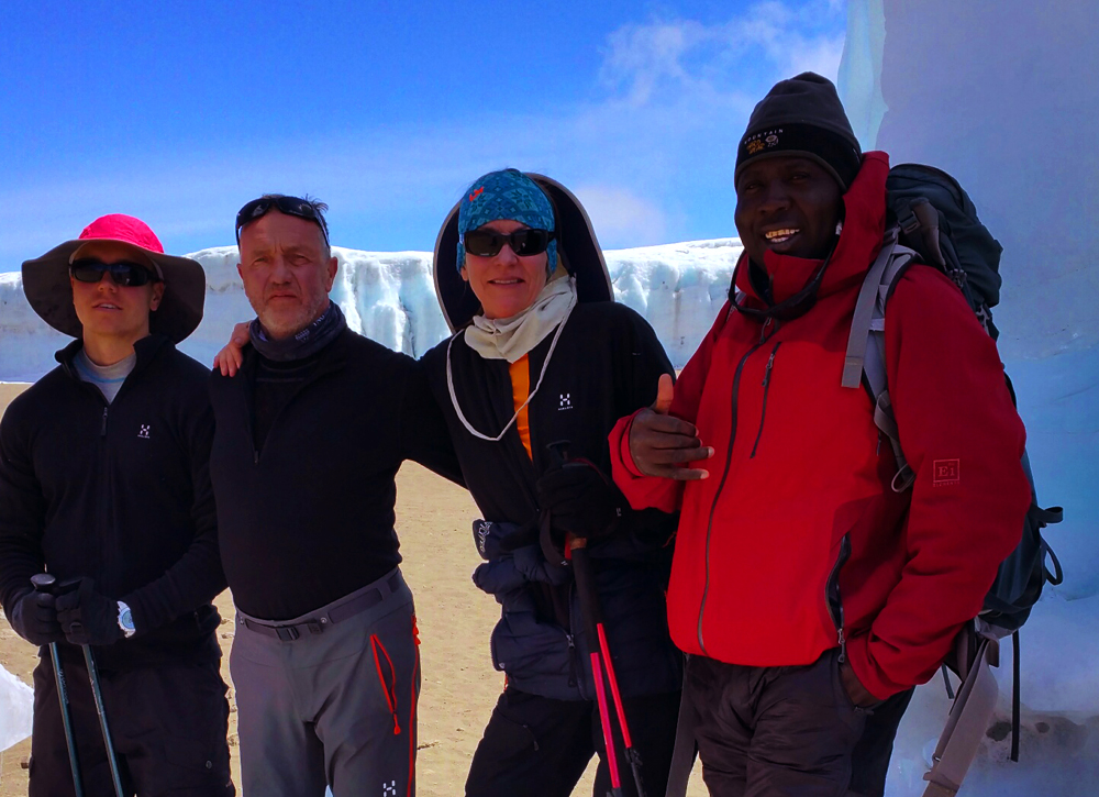
The moment we arrive at Uhuru Peak is a wonderful occasion that we will never forget! Some will cry, others will quietly take in the moment.
We have done it!
After a cold night but fantastic scenery as the sun rose over Mawenzi, and an incredible 30 minutes at the summit, we gather ourselves for the downhill walk to Stella Point!
It takes about 20 minutes from the summit to Stella Point where we may still see climbers arrive in zombie-like conditions! In the daylight the uphill hike from Barafu to Stella Point looks very steep!
Be prepared for a shock - the way down is a steep, rigorous route from Stella Point down the mountain to Barafu where we stop for lunch. Adjust both your poles to long.
At Stella Point, consider removing your warmer outer layers and make sure your gaiters are properly tied to prevent sand from entering your boots.
Many hikers are unprepared for this 4-hour ordeal down the slippery slope of scree. Don't be. The sun will beat down and we will soon curse our 4-layers of summit wear!
We sweat and eat dust like rodeo cowboys! It is rough going!
At Barafu we take a good rest before tackling the rest of the way down. Some people try to sleep a bit. We think it is better to keep on going.
The day is clearly not over yet. We must continue down the mountain for another 3 hours of serious downhill walking.
We reach Mweka Camp in the late afternoon, and scramble to be first in the shower (if provided by the outfitter)!
Dinner tonight is a joyous celebration with local cuisine!
Sadly, it is our last night on Kilimanjaro. We are at 10146ft (3092m).
Please watch the Machame video and then read the additional route information below!
Machame Video to follow soon!
We hike 5.5 miles (8.55km) from Mweka Camp to the gate at 5360ft.
Breakfast is served at 8:00 and we depart at 9:00am.
Today is a surprisingly challenging and steep downhill walk through the rainforest to the park gate.
When it rains, the trail is muddy and very slippery. We use our poles to prevent knee or ankle injuries.
There are many other climbers on this trail and plenty of stories and experiences to share. It is noisy all the way to the gate—arrival at noon!
At the gate, we are treated with a final feast of fruits and drinks, and an opportunity to buy a few souvenirs! Then we sign the register and gather for the presentation of our climbing certificates by our guides, followed by a short tipping ceremony.
Sadly, it is time to say goodbye to our mountain team. With their assistance, we achieved something extraordinary !
Our cars are waiting and we wave teary-eyed goodbyes to our porters.
Our Kilimanjaro experience is over!